
Trace a Manchester Street Parcel by Parcel
A useful street directory is a walk through records, not a single name list. In Hartford County, begin with the address as it is written today. Vision can return an owner, account, PID, MBLU, situs address, mailing address, and property traits. The GIS viewer can then show the parcel shape, address point, road, building, and adjacent lots. RecordHUB is the legal layer for a deed, mortgage, release, lien, map, or other filed instrument. Each result adds a different kind of evidence.
Save the parcel identifier before moving on. Corner lots, condominium units, and parcels with several buildings may produce more than one assessment entry. Keep the street spelling, directional, unit, postal ZIP, and legal description in separate fields. That record of the search is especially important in Manchester, where a postal label can cross a municipal line and a historic directory may use a village name instead of a modern standardized address.
- Enter the normalized address in Vision and save owner, PID or MBLU, situs, mailing address, valuation history, and any map or report link.
- Open the Town GIS Parcel Viewer with the address, RPKEY, or street name. Click the target parcel and then the surrounding parcels one by one.
- Use the parcel's legal description or map reference to search the Town Clerk's RecordHUB land index. The live grantor and grantee controls require portal access, so verify the current screen.
- Search the seller as the next grantee to work backward. Add permit history, directories, newspapers, or census schedules when the question is about occupancy or age.
- Stop at the record's limit. Ask the Town Clerk, Engineering/GIS unit, Building Division, library, or History Center for a paper, scan, or reference route when an online result is incomplete.
Manchester Street Records by Address
Manchester has no county recorder that substitutes for the Town Clerk. The central land-record office at 41 Center Street holds local deeds, mortgages, maps, releases, liens, foreclosure registrations, and trade names. The address tools around it belong to separate town units. The table gives a street directory its proper order of operations.
| Address-keyed source | What it shows | Access | Street-use caution |
|---|---|---|---|
| Vision Address search | Owner, account, situs and mailing address, PID/MBLU, values, features, sales route | Free public search | Owner is not every occupant |
| Town GIS viewer | Parcel shape, address points, ranges, buildings, roads, and adjacent layers | Free map and reports | Not a legal survey |
| RecordHUB | Title parties, deeds, maps, liens, mortgages, releases, and legal descriptions | Portal, books, clerk help | Search fields are account-gated |
| CSS permits | Plan, permit, project dates, work type, public details, and attachments | Public search without login | Permit is not title |
| Voter status | One exact name and date-of-birth status check | State lookup and Registrar | Not a street-wide browse |
A complete address record keeps property, title, permit, voter, and history sources distinct. It avoids calling the assessor a resident roll or treating a public map as a list of household members.
Vision Street Listing and Search Fields
Vision's opening screen offers five search modes: Address, Owner, Acct#, MBLU, and PID. Street Listing is a separate control for browsing a named street. The result may contain owner and mailing context, assessment values, land use, acreage, frontage, depth, zoning, neighborhood, building traits, extra features, outbuildings, and valuation history. The sales search adds a date range defaulting to January 1, 2011 through the current date, along with price, land, building, model, neighborhood, and style filters.
| Address | Enter a street address using Manchester's directional and street-name conventions. |
|---|---|
| Owner | Search a printed owner name; one name may return more than one parcel. |
| Acct# or PID | Use the assessment account or parcel identifier when an address has changed. |
| MBLU | Map, map cut, block, block cut, lot, unit, and unit cut pieces. |
| Street Listing | Browse the street control, then preserve each parcel ID rather than only the visible number. |
The Vision Manchester address and owner screen is the best starting image for an address directory because it shows the modes that are actually available.
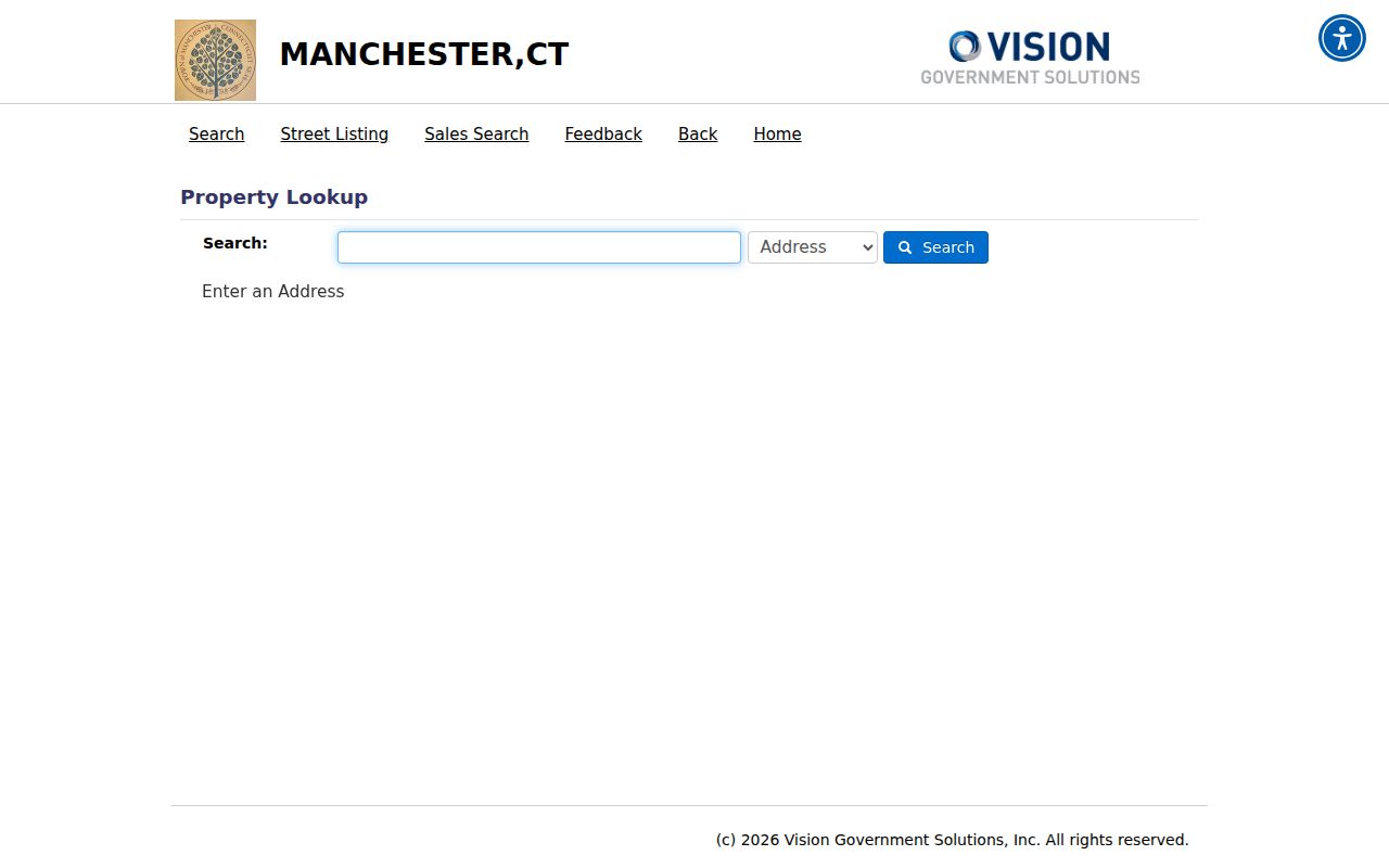
The screen does not show a ZIP field on its opening view. Group a street by verified postal result only after checking the address in USPS and comparing the parcel in GIS.
The Vision Manchester sales search adds a separate set of property filters that can help place a transfer or parcel change in time.
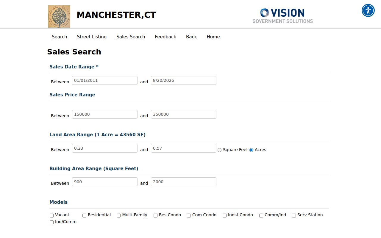
The sales screen includes date, price, land, building, model, neighborhood, and style controls. Its default date window is a search setting, not a claim that the public sales history begins in that year.
Walk Adjacent Parcels in Manchester GIS
The Town GIS Parcel Viewer turns a street directory into a map walk. Search by address, RPKEY, or street name, click the parcel, and keep the surrounding boundaries visible. Useful layers include parcels, address points and ranges, buildings, roads, lot size and dimensions, zoning, overlay zones, flood areas, wetlands, historic areas, easements, private rights of way, utilities, sidewalks, driveways, bridges, and public boundaries.
Use “Create Property Report” or “Create Property Map” only after selecting a parcel. The viewer also exposes download controls, a basemap switch, and a feedback form. The published GIS documentation warns that the data is compiled from deeds, filed plans, and public records, updated as needed, provided without warranty, and not suitable for a legal boundary determination. A broad map view can also be limited by service query caps.
For the immediate block, click each adjacent parcel and carry its PID or RPKEY into Vision. A Manchester neighbors lookup is the better focus for that smaller block question, while the address chain remains the whole-street record.
Turn a Manchester Address into Title History
RecordHUB's land records and maps are described as 1823-current. The index and images are available under portal terms, while paper books and clerk assistance remain important for old or hard-to-read material. Use the assessment record to find the current owner and legal description, then use RecordHUB to connect that person to the filed instrument. A street number alone can miss a deed that is indexed under a lot, map, or metes-and-bounds description.
- Write down the current Vision owner, parcel ID, MBLU, situs, mailing address, and legal-description language.
- Search the current owner as a grantee and check the likely purchase deed, recording date, book/page or document number, and map reference.
- Read every grantor, grantee, easement, restriction, release, mortgage, lien, and related map listed with the filing.
- Take the grantor from the purchase deed and search that person as a grantee. Repeat the chain backward through earlier transfers.
- If the image is illegible or a portal result is missing, call the Town Clerk at 860-647-3037 or request an original-book or rescan route.
- Parcel
- A mapped property unit used by assessment and GIS systems.
- Situs address
- The physical location of the parcel, distinct from a mailing address.
- Plat or map
- A filed drawing that helps connect lots, boundaries, and street layout.
- Criss-cross directory
- An address- or street-ordered historical directory section, when a local volume includes one.
Manchester Permit Search by Address
The Building Inspection Division's CSS portal adds a building-history layer to the address trail. A visitor can choose Plan, Permit, or All, enter an address, plan number, or permit number, narrow the results, and open public detail or attachments when available. The portal is open for public searching; an account is for a person's own applications and account actions.
Manchester's address examples are worth keeping beside a research log. The permit guidance suggests trying `494 Main St` or `494 Main`, using `MIDDLE TPKE W` and `MIDDLE TPKE E`, and using `E CENTER ST` and `W CENTER ST`. A project may reveal a permit date, work type, applicant, contractor, inspection or certificate attachment, but it does not prove title or establish who lived at the address.
The Manchester public permit search is the source for the live category and address controls.
The captured permit screen makes the Plan, Permit, and All choices visible. Confirm posted status with the Building Division at 860-647-3052 because the town reports staffing-related processing and inspection delays.
Street Names Manchester Portals Recognize
Manchester's addressing instructions describe a town-wide effort to standardize a house number, street name, street type, directional, and unit. Do not put letters in the house-number field. Keep `UNIT` separate from the street number. The same address can be written differently by a directory, permit portal, deed, map, or USPS.
Try the town's recognized forms before concluding that a record is missing. Main can be searched with or without “St.” Middle Turnpike has west and east forms, and Center Street has east and west forms. For historical records, add South Manchester, North Manchester, Parker, Highland Park, Hilliardville, Meekville, or Taylorville when the source uses a village label. Then bridge the result back to the current parcel and legal description.
There is no verified official chronology of every renumbering or street renaming in the sources reviewed. That is why a failed exact-address search should trigger variants and map references, not a conclusion that no earlier resident record exists.
The Voter File Is Not Streetwide
Connecticut's voter lookup is a person-status tool. It asks for a full first name, last name, and date of birth and may return registration status, party, polling place, or absentee status. The Manchester Registrar of Voters at 479 Main Street can help when the exact match fails. The state does not turn that free lookup into a public “everyone on this street” browse.
The full CVRS file is a different request. It is a $300 CSV with certification of an election-related, scholarly, journalistic, political, or governmental use. Personal or commercial use, advertising, solicitation, marketing, sale, reproduction, and harassment are restricted. A street directory should therefore describe the lawful, narrow status route rather than copy or promise a neighborhood voter list.
Historical Manchester Addresses and Directories
Manchester Public Library's directory shelf begins with 1891, and the Manchester History Center holds maps, yearbooks, business directories, and local books. The Historical Society's named runs include 1917, 1922, 1927, 1934, and 1946, with later Price & Lee holdings for 1943 and 1953-54. A reverse or criss-cross volume is not separately verified as a complete Manchester run, so ask reference staff whether the year is alphabetical, street-ordered, business, or telephone.
The library's Manchester Newspaper Database, Hartford Courant access, ResearchIT CT, census schedules through 1950, yearbooks, cemetery books, and Cheney oral histories can add names to an old address. A directory entry can identify a historical occupant or business, while a deed identifies a title party. Pair the two rather than treating either one as a complete street directory.
Layers That Do Not Name People
The GIS service displays useful physical context: zoning, flood and wetland areas, easements, public rights of way, utility lines, buildings, roads, lot dimensions, historic overlays, and public boundaries. Those layers can explain why a parcel is shaped a certain way or why a permit took a particular route. They do not name utility customers, delivery recipients, household members, or every person present.
The Collector of Revenue supplies tax payment and delinquency routes, but no separate open owner-name tax roll was located. Police Records can accept report requests, subject to exemptions. DMV information is protected under the Driver's Privacy Protection Act. Keep these nonpeople layers in the street directory as context, not as a shortcut to private household details.
Manchester Street Directory Privacy Limits
Property records usually show an owner or tax-bill destination, not a complete household. A mailing address may belong to a trust, corporation, bank, attorney, or prior owner. Safe at Home participants may use a substitute address, and protected voters may be omitted or represented differently. Utilities, deliveries, and DMV addresses are not ordinary public street-directory fields.
Lawful use. Use Manchester by-address records for family history, a house-history project, civic research, or personal safety awareness. Do not use a street directory to watch, harass, intimidate, or harm a person.
When the goal changes from a whole street to one person, use the Manchester resident lookup workflow. A smaller block question needs different evidence and different privacy care.
ZIP Labels Along Manchester Streets
Postal geography can blur a street directory. SOTS identifies Manchester 06040 and Bolton Station 06043 in the local postal table. Other official Connecticut location material displays Manchester labels 06041, 06042, and 06045, but the sources reviewed do not establish complete delivery-area or PO-box boundaries for each. The GIS service includes a ZipCodes layer, while USPS supplies the final address-to-ZIP+4 check.
Store the municipal town, postal city, ZIP, ZIP+4, situs, and mailing address separately. A ZIP can cross a town line, and a mailing label can differ from the parcel's legal location. The ZIP directory explains that mismatch before a ZIP grouping is used to organize street-level work.